INSPIRE - Annex II Theme Orthoimagery - OrthoimageCoverage 2016 Infrared
From Géoportail
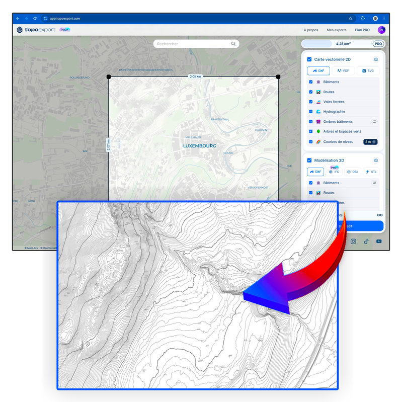
This layer contains the official infrared orthophotos covering the national territory of Luxemburg, and that have been produced following a surveying flight in summer 2016 under the responsibility of the administration du cadastre et de la topographie. The pixel size is 25cm. Due to storage…
Metadata quality:
Data description filled
Files documentation missing
License filled
Update frequency not set
File formats are open
Temporal coverage not set
Spatial coverage filled
Updated 2 weeks ago