INSPIRE - Annex II Theme Orthoimagery - OrthoimageCoverage 2023
From Géoportail
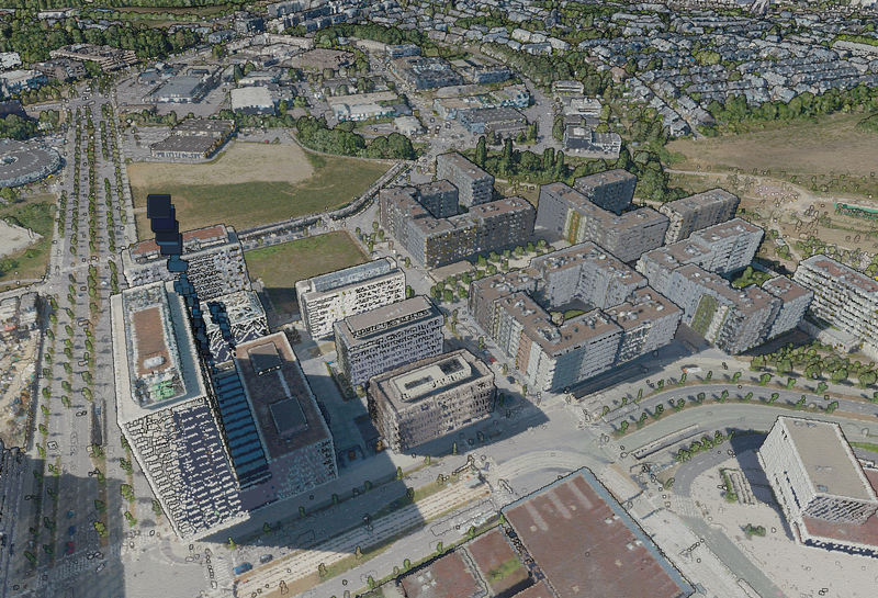
This layer contains the official orthophoto resulting from the 2023 aerial survey with a ground resolution of <= 10 cm per pixel (GSD). The absolute planimetric accuracy of the orthophoto can be indicated with a Root Mean Square Error (RMSE) <= 20 cm. The overcoverage is <= 15% in the municipal…
Metadata quality:
Data description filled
Files documentation missing
License filled
Update frequency not set
File formats are open
Temporal coverage not set
Spatial coverage filled
Updated 2 weeks ago