Skip to content
The luxembourgish open data platform
Search for data
Open menu
Log in
Sign up
EN
FR
Close
Search for data
Search for data
Close
EN
FR
Data
Reuses
Organizations
Contribute
Publish a dataset
Publish a reuse
News
Contact us
Home
Reuses
1 to 1 on 1
Reuses
Search among 136 reuses on Portail Open Data
Search in datasets
Search...
Search
All
International matters
Agriculture
Justice, Law and Public Order
Economy and Finance
Energy and natural resources
Environment and Climate
Government and public sector
Population and society
Regions and local development
Health
Science and Technology
Transport - Charging points
Transport - IDACS
Transport
Education, culture and sport
Geospatial data
Earth observation and environment
Meteorological data
Statistics
Mobility
Others
1 results
Sort by
Relevance
Newest
Oldest
Followers
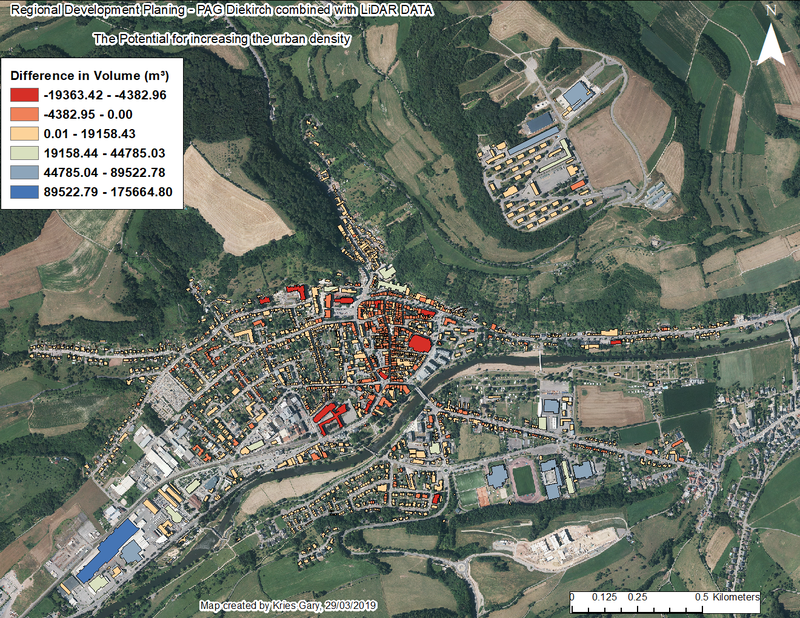
Combination of LiDAR data and the PAG Diekirch
Idea
Published on March 29, 2019 by Gary Kries