
Registre national des localités et des rues caclr
Description
Ce registre constitue la référence officielle pour les adresses luxembourgeoises.
Le registre contient
- les noms officiels pour les entitées: canton, commune, localité, rue
- les numéros d'immeubles dans une rue
- le code postal des rues et immeubles
Le registre ne contient pas:
- les coordonnées géographiques des adresses
- les noms de localité et/ou rue en différentes langues
- les désignations des quartiers
Législation et compétences:
Le registre est géré par l'administration du cadastre et de la topographie sur base de l'article 2(g) de la loi du 25 juillet 2002 portant réorganisation de l'administration du cadastre et de la topographie.
Les administrations communales sont tenues de communiquer les adresses officielles au registre afin de répondre aux conditions des articles 5(2) et 33(1) de la loi modifiée du 19 juin 2013 relative à l'identification des personnes physiques et de l'article 23 de la loi modifiée du 13 janvier 2019 instituant un registre des bénéficiaires effectifs.
L'exhaustivité des données ne peut être garantie.
Producer
Latest update
March 23, 2026
License
Metadata quality:
Data description filled
Files documented
License filled
Update frequency followed
File formats are open
Temporal coverage not set
Spatial coverage filled
Metadata quality
Temporal coverage not set
5 Reuses
Npm package pour obtenir les rues/villes d'un code…
API
Published on October 8, 2023 by Julien Galego

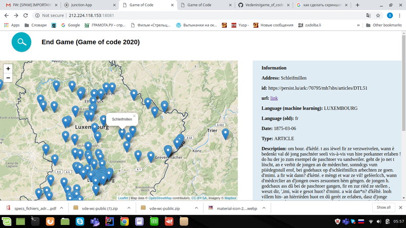
End Game (Game of code 2020) - Show historical events…
Application
Published on October 11, 2020 by Slava Viacheslav
These resources are published by the community and the producer isn't responsible for them.
Information
Tags
License
ID
56fd152d0d6ceb6744b6f9f2
Temporality
Creation
March 31, 2016
Frequency
Monthly
Latest update
March 23, 2026
Spatial coverage
Territorial coverage granularity
Other