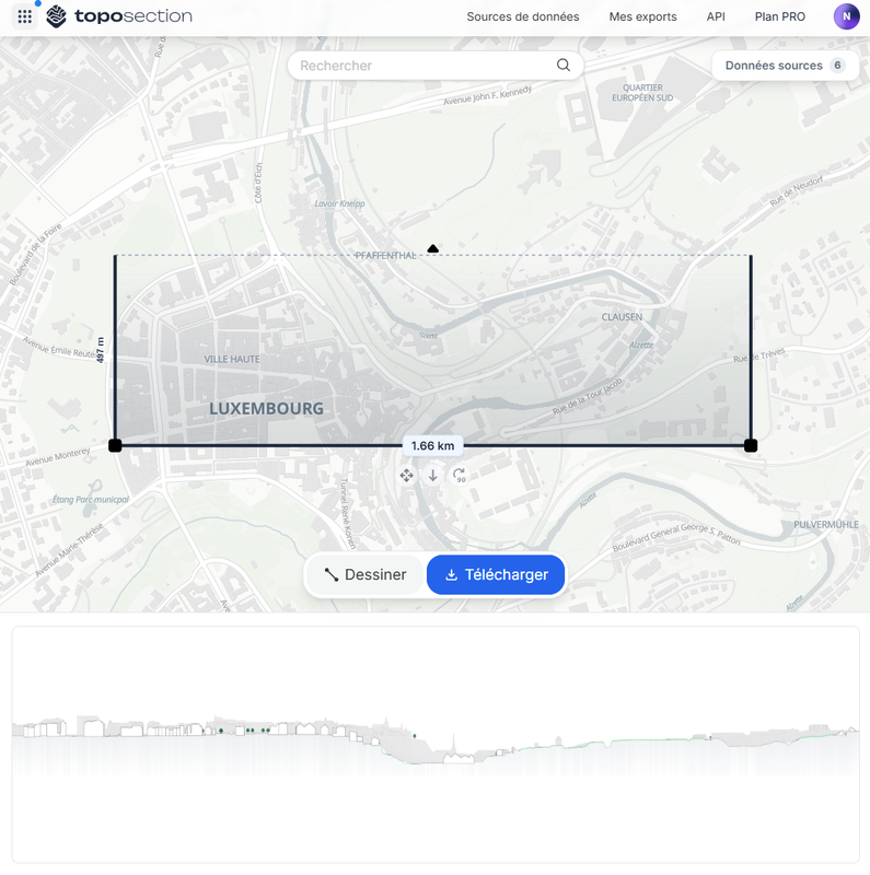
TopoSection.com - Online Landscape and Urban Section…
Application
Published on January 3, 2026 by TopoExport (CAD & BIM)

This is a degraded experience of Portail Open Data. Please enable JavaScript and use an up to date browser.
The BD-L-GeoBase is the official reference for geographic vector data produced by the Administration du Cadastre et de la Topographie for the entire territory of the Grand Duchy of Luxembourg.
The dataset is structured in six themes:
The dataset is available as geopackage (.gpkg) and geodatabase (.gdb) and as separate datasets or as a complete package.
Coordinate reference system : LUREF LTM / EPSG2169
Further details can be found in the dataset contents description below.
April 1, 2026
Data description filled
Files documented
License filled
Update frequency followed
File formats are open
Temporal coverage not set
Spatial coverage filled
Temporal coverage not set
Application
Published on January 3, 2026 by TopoExport (CAD & BIM)
Application
Published on September 19, 2025 by TopoExport (CAD & BIM)
There are no discussions for this dataset yet.
There are no community resources for this dataset yet.
66d82e8cd69ea79173e85f42
September 4, 2024
Quarterly
April 1, 2026
Luxembourg
Luxembourg